Cyclones are among the most powerful and destructive natural events on Earth, capable of reshaping coastlines, disrupting economies, and affecting millions of lives in a matter of hours. Every year, countries like India, Bangladesh, the Philippines, and the United States experience severe cyclonic storms that bring intense rainfall, powerful winds, and widespread flooding. Despite their frequent occurrence, many people still do not fully understand what a cyclone actually is, how it forms, or why it becomes so dangerous.
Table of Contents
What Is a Cyclone?
A cyclone is a large-scale weather system characterized by a low-pressure center around which winds rotate rapidly. These winds spiral inward toward the center and are often accompanied by heavy rainfall, thunderstorms, and strong gusts. Cyclones usually develop over warm ocean waters, where they gain energy from heat and moisture.
The word “cyclone” refers to the circular motion of winds. In the Northern Hemisphere, cyclones rotate counterclockwise, while in the Southern Hemisphere, they rotate clockwise due to Earth’s rotation. Although the name may differ across regions—such as hurricanes in the Atlantic and typhoons in the Pacific—the phenomenon remains essentially the same.
Why Cyclones Occur
Cyclones form due to a combination of atmospheric and oceanic conditions. The primary driver is the presence of warm ocean water, which heats the air above it. As this warm air rises, it creates a low-pressure area near the surface of the ocean. Surrounding air rushes in to fill this gap, and as it moves, it begins to spin because of the Coriolis effect, which is caused by Earth’s rotation.
This spinning motion becomes more organized over time, and as more warm, moist air rises, the system continues to grow stronger. Essentially, a cyclone is like a giant heat engine that converts ocean heat into wind energy.
How a Cyclone Forms
The formation of a cyclone is a gradual process that involves several stages. It begins with warm ocean water, typically above 26–27°C, which provides the energy needed for development. As the sun heats the ocean surface, warm air rises and creates a low-pressure area below. This triggers a chain reaction where cooler air moves in, heats up, and rises again.
As this cycle continues, the system starts to rotate due to Earth’s spin. Over time, clusters of thunderstorms begin to organize into a circular pattern. When the system becomes strong enough, it develops into a tropical depression, then a tropical storm, and eventually a full-fledged cyclone if conditions remain favorable.
One of the most recognizable features of a cyclone is the formation of the “eye,” which is a calm, clear region at the center of the storm. Surrounding the eye is the eyewall, where the most intense winds and rainfall occur.
Cyclone Structure and Key Environmental Drivers
A cyclone is not just a chaotic storm; it has a well-defined structure. At the center lies the eye, which is surprisingly calm and often clear. This region has the lowest air pressure and is typically surrounded by the eyewall, which is the most dangerous part of the cyclone. The eyewall contains the strongest winds and the heaviest rainfall.
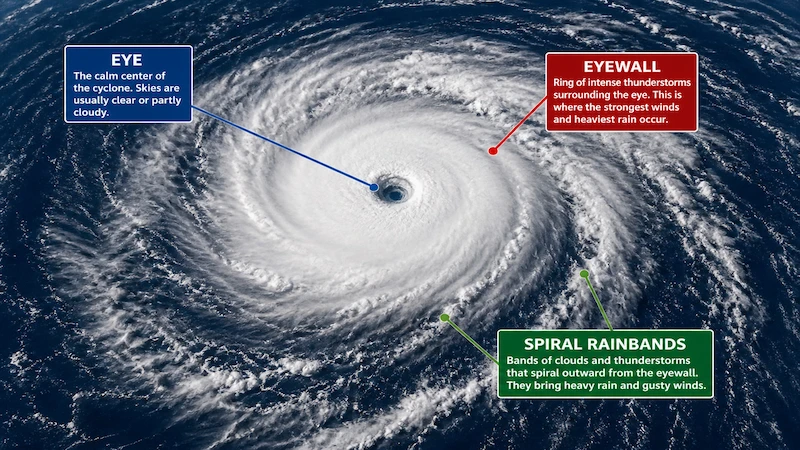
Beyond the eyewall are spiral rainbands that extend outward. These bands consist of clouds and thunderstorms that produce intermittent rain and gusty winds. The entire system can span hundreds of kilometers, affecting large geographical areas.
Environmental Drivers
Cyclone intensity and track depend on large-scale environmental factors:
- Sea Surface Temperature (SST): Warm water is the energy source. Generally, cyclones intensify when crossing waters ≥26°C, and rapid intensification is favored over very warm currents (e.g. Loop Current in Gulf of Mexico). Cooler SSTs weaken them. Global trends in ocean warming have also influenced cyclone intensity patterns (e.g. poleward shift of tropical cyclone tracks).
- Coriolis Force: Arises from Earth’s rotation; necessary to spin up the cyclone. It is zero at the equator, so hurricanes never form within ~5° latitude of the equator. In the Northern Hemisphere it causes counterclockwise rotation, and clockwise in the Southern Hemisphere.
- Vertical Wind Shear: The change of wind with height. Low vertical shear allows a storm’s vertical column to remain aligned, promoting intensification. High shear tears apart the convection, tilting the vortex and often weakening the storm. Hurricanes often encounter shear as they move out of the tropics, which can initiate extratropical transition.
- Atmospheric Moisture: Humid mid-troposphere allows deep convection; dry air can intrude and weaken a cyclone by robbing moisture. African dust or Saharan Air Layer outbreaks (dry, dusty air) can suppress Atlantic hurricanes.
- Pre-existing Vorticity: Seeds like tropical waves or monsoon gyres supply initial spin. Tropical cyclones cannot form from a completely homogeneous atmosphere; they need some rotation to concentrate.
- Upper-level outflow patterns: Diffluent wind patterns aloft help ventilate the cyclone. Features like the tropical upper-tropospheric trough (TUTT) can sometimes enhance outflow on one side of a storm, or conversely increase shear on another.
- Large-scale steering currents: Mid-level wind patterns (e.g. subtropical ridge, mid-latitude troughs) determine the storm track. A strong ridge can force a cyclone westward or poleward; a trough can recurve it east or northeast.
Types of Cyclones
Cyclones are classified into different types based on where they form and the conditions that create them. The most well-known type is the tropical cyclone, which forms over warm ocean waters near the equator. These are the storms that cause the most damage due to their intensity and size.
Extratropical cyclones, on the other hand, form outside the tropical regions and are driven by temperature differences between air masses rather than warm ocean water. These are common in mid-latitude regions and can also bring strong winds and heavy rainfall.
Polar cyclones occur in the polar regions and are generally smaller and less intense, but they still play an important role in global weather patterns. Another type, known as mesocyclones, is associated with thunderstorms and can lead to tornado formation.
| Type of Cyclone | Where It Forms | Key Characteristics | Common Names |
|---|---|---|---|
| Tropical Cyclone | Warm ocean waters near equator | Strong winds, heavy rain, needs warm sea (26–27°C+) | Cyclone, Hurricane, Typhoon |
| Extratropical Cyclone | Mid-latitude regions | Forms due to temperature differences between air masses | Winter storms |
| Polar Cyclone | Polar regions | Cold-core system, smaller in size, less intense | Polar low |
| Mesocyclone | Within thunderstorms | Rotating air column, can lead to tornado formation | Tornadic system |
Cyclone Categories Based on Intensity
In India, cyclones are classified based on wind speed, ranging from depressions to super cyclones. As wind speeds increase, the potential for damage also rises significantly. A depression is the weakest form, while a super cyclone represents the most extreme category with devastating winds and rainfall.
| Category | Wind Speed (km/h) | Description |
|---|---|---|
| Depression | 31 – 49 km/h | Weak system with low impact |
| Deep Depression | 50 – 61 km/h | Slightly stronger, can bring moderate rain |
| Cyclonic Storm | 62 – 88 km/h | Named storm, noticeable damage possible |
| Severe Cyclonic Storm | 89 – 117 km/h | Strong winds, structural damage begins |
| Very Severe Cyclonic Storm | 118 – 166 km/h | Major damage to infrastructure |
| Extremely Severe Cyclonic Storm | 167 – 221 km/h | Severe destruction, high risk to life |
| Super Cyclone | 222 km/h and above | Catastrophic damage, extreme danger |
This classification helps authorities issue warnings and prepare disaster response measures in advance.
Cyclone-Prone Areas in India
India is particularly vulnerable to cyclones due to its long coastline and tropical climate. The eastern coast, especially along the Bay of Bengal, experiences more frequent and intense cyclones compared to the western coast along the Arabian Sea.
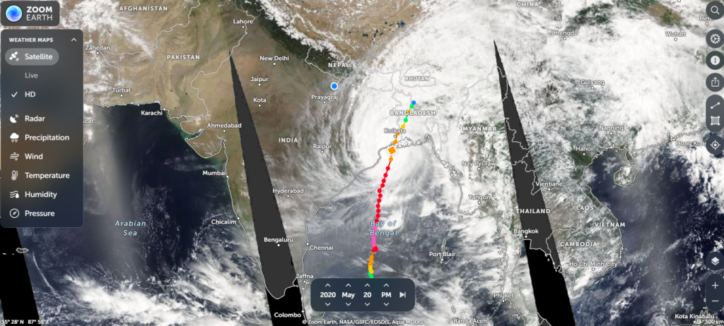
States like Odisha, West Bengal, Andhra Pradesh, and Tamil Nadu are often the most affected. Gujarat on the western coast also faces cyclonic threats, although less frequently.
Why Cyclones Are So Dangerous
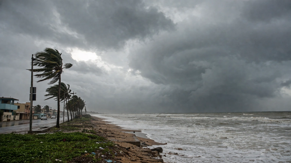
Cyclones are dangerous not only because of strong winds but also due to the combination of multiple hazards they bring. One of the biggest threats is storm surge, where sea levels rise dramatically and flood coastal areas. This can cause massive destruction and loss of life.
Heavy rainfall associated with cyclones often leads to flooding and landslides, especially in low-lying areas. Strong winds can uproot trees, damage buildings, and disrupt power and communication systems. Together, these factors make cyclones one of the most destructive natural disasters.
Impact of Cyclones
The impact of cyclones can be devastating on both human life and the environment. Thousands of people may be displaced, homes destroyed, and livelihoods disrupted. Agricultural fields can be flooded, leading to crop loss and economic hardship for farmers.
Infrastructure such as roads, bridges, and power lines often suffers significant damage, affecting daily life and slowing down recovery efforts. Environmentally, cyclones can cause coastal erosion, damage ecosystems, and contaminate water sources.
Cyclones and Climate Change
There is growing evidence that climate change is influencing cyclone patterns. Rising global temperatures are warming ocean waters, which in turn provides more energy for cyclones to intensify. This means that while the number of cyclones may not increase significantly, their intensity and rainfall are likely to become more severe.
As a result, regions that were previously less affected may start experiencing stronger storms, making preparedness even more critical.
How Cyclones Are Predicted
Modern technology has made it possible to predict cyclones with greater accuracy. Meteorological agencies use satellites, radar systems, and computer models to track storm development and movement.
In India, the India Meteorological Department is responsible for monitoring cyclones and issuing warnings. Early warnings help governments evacuate people, prepare emergency services, and reduce damage.
Safety Measures During a Cyclone
Preparation is key to minimizing the impact of cyclones. Before a cyclone strikes, it is important to stay updated with weather alerts, prepare emergency supplies, and secure your home. During the cyclone, people should remain indoors, avoid windows, and follow official instructions.
After the cyclone passes, it is important to avoid flooded areas, check for damage, and ensure safety before resuming normal activities.
Also Read: What is El Niño and La Nina? How It Impacts India’s Monsoon and Weather Patterns
Difference Between Cyclone, Hurricane, and Typhoon
Although different terms are used, cyclone, hurricane, and typhoon all refer to the same type of storm. The difference lies only in the region where they occur. In the Indian Ocean, it is called a cyclone; in the Atlantic, it is known as a hurricane; and in the Pacific, it is called a typhoon.
Cyclones are complex and powerful natural systems that can have devastating effects on human life and the environment. Understanding what a cyclone is, how it forms, and its different types is essential for awareness and preparedness.
As climate change continues to influence weather patterns, the importance of early warning systems and disaster management will only increase. Staying informed and prepared is the best way to reduce the risks associated with cyclones.
Frequently Asked Questions (FAQs)
-
What is a cyclone in simple terms?
A cyclone is a large storm with rotating winds around a low-pressure center, often bringing heavy rain and strong winds.
-
How does a cyclone form?
It forms over warm ocean water when moist air rises and creates a low-pressure system that begins to rotate.
-
What are the main types of cyclones?
The main types include tropical cyclones, extratropical cyclones, polar cyclones, and mesocyclones.
-
Who predicts cyclones in India?
The India Meteorological Department (IMD) is responsible for forecasting and issuing cyclone warnings.
For more latest updates on Trending News, Automobile, Education, Technology, Jobs, weather and sports visit IndicDaily.